Tuesday, 8 October 2013

Life as an AGI Council Member

Abigail Page, AGI Council member
With the call for nominations to AGI Council for 2014 open, Chris has asked me to write a guest blog this week about being a member of AGI Council – so here it goes!

Standing for Election

I have been involved with AGI for a number of years, firstly as a regular member and delegate at AGI GeoCommunity conferences, then with the AGI Environment SIG and the AGI Scotland Committee.

At the AGI GeoCommunity 2012, Andy Coote suggested gently that I should consider standing for Council. I spent a long time thinking about this (probably a bit too long since I then had to rush to get my form in on time!) and speaking to some other council members, the AGI team and my employer about the level of commitment required before putting myself forward. The process is very straightforward and there is more information on the AGI website.

Council Meetings & Key Tasks

Council meet a minimum of 5 times a year at AGI HQ in London. It can be a long day (particularly including a round trip from Edinburgh!) but it is a great opportunity to catch up with  other Council members and really important that we all have this time to consider AGI business away from our day jobs.

In addition to directing the strategy of the AGI, there is a requirement for Council members to support regional groups and SIGs and to provide an additional resource and operational support to the AGI team. During 2013 I have been involved in the organisation of Showcase Events and the Council Marketing group. Our marketing and communication activities have taken a big step forward this year, including the successful appointment of Chris, and I am confident that you will start to notice positive changes in the coming months if you haven't already.

Being a Representative

Of course being a Council member isn't just about attending meetings and providing operational support – it is also about being available to members and the wider community as a representative of both AGI and AGI Council.

The AGI team are small and do an excellent job with the limited resource they have – but this is not enough to grow AGI and maintain a strong membership and voice in UK GI.  With being elected to council comes an expectation to perform the role of an AGI  and UK GI Ambassador. From my own perspective, this has included being visible and present at UK events, speaking actively about the role of the AGI and looking to engage and collaborate with other organisations that share our views on the role of geospatial and geography in the UK.

However, I would like to add a note that this is a role that all AGI members can play, whatever your role in the industry. We need you to be ambassadors for the AGI and GI – AGI members play a vital role in the UK GI industry and together we can have immense reach and drive forwards our collective desires and ambitions.
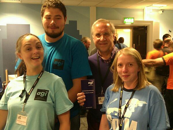
Spot me at State of the Map 2013 – the Disadvantages of being Vertically Challenged (Image: Chris Fleming)

Time Juggling & The Benefits

Where do I find time volunteer as an AGI Council member? Jo Cook mentioned the term “task-management ninja” in her blog post summing up experiences of organising FOSS4G and I can really relate to this as I suspect can most of my Council colleagues.

I am lucky to have a patient husband and family in addition to a supportive employer that recognise the value of my AGI input to my own professional development and the benefits to Central Scotland Forest Trust (CSFT) as an organisation. Without this support and flexible working arrangements, it would be difficult to keep my Council commitments and this is why I would really recommend having these discussions openly before you stand for Council.

Yes, it is a lot of hard work, but I am not a selfless person. Of course, I believe in a strong UK GeoCommunity and the AGI, but if I were not getting something back from my involvement then I wouldn't be doing it. It is incredibly personally satisfying to have direct input into shaping the AGI.

Post- Council Team Networking
During the last nine months on Council I have had the opportunity to meet and work with some of the most influential and inspiring members in our GeoCommunity. I have developed a wide range of skills and experience as a Council Member and Director that have been incredibly useful elsewhere. It has raised my own professional profile and influenced the way that I work in addition to bringing forward new ideas and opportunities for CSFT as we develop and realise the Central Scotland Green Network. Finally, being involved in AGI Council and working as part of a great team with shared ambition is immense fun!

So, that's it (I hope this is what you wanted Chris!). If I haven't put you off please consider standing for election either this year or some point in the future. Get in touch with any of us on Council or the AGI Team if you need any further information. Remember that there are many other ways to support the AGI and get involved – SIGs & Regional Groups always welcome able and enthusiastic volunteers, and it is up to all of us to be AGI and industry Ambassadors and develop our strong GeoCommunity.

Thursday, 3 October 2013

We’ve had State of the Map now it’s time for ‘State of the Conferences’

Maptember is over and with it the flurry of long days, scribbling notes (or typing if unlike me you've embraced technology and have a tablet) and appending ‘geo’ onto every conceivable noun. We've already published reviews on some of the events that took place throughout September but I wanted to review the geo conference scene as a whole and look at its relevance in 2013. Now I'm going to be honest and say that the AGI are currently working on revamping our conference offering for 2014 including GeoCommunity but I will try and steer clear of the promotional here.

I was lucky enough to attend both GeoCom and FOSS4G and have spoken to several colleagues and previous total strangers who were at the BCS and SotM events so feel I have a reasonable overview of how the events went.

This first thing I was struck by was the attendance levels for these events. My understanding is that the events industry in general is still having a tough time as training and travel budgets remain low in most organisations, particularly the public sector. As a result it is hard for employers to justify both the price and the time out of the office for staff to attend these events. However delegate numbers across the September events remained high, despite the pile up of events competing for largely the same pool of potential delegates. Obviously FOSS4G being an international conference saw the largest attendance, with the majority of delegates coming from outside the UK but GeoCom and SotM were also very busy. However one thing that we did notice whilst processing bookings for GeoCom and FOSS4G was how late the bookings were coming in. For both events we had bookings right up to the very start of the event itself despite both events offering significant discounts for early bookers. From this I am concluding that in the current climate it is less cost than time out of the office that is a stumbling block for conference attendance and many employers are waiting until the last minute before giving staff the OK to attend.

Given the levels of attendance it would seem that the industry as a whole still see value in sending their staff to residential conferences and that things like webinars and video conferencing are not providing the substitute that many predicted despite the tougher financial climate. For sponsors and exhibitors conferences are still seen as valuable, partly for generating new leads and just general brand visibility but also as an opportunity to get a number of their clients (or suppliers) together in one place for account management and relationship building. Interestingly from speaking to sponsors and delegates at the conferences it seemed that the rather old fashioned ability of conferences to gather lots of similar people in one place was one of their biggest attractions as increased business travel and remote working make it much harder to tie people down.

For delegates the most important thing seemed to be (anecdotally) getting a chance to see what others in the industry were up to (and show off what they were doing) and generally to get a sense that the industry was developing and moving forwards. Particularly in a time of reigned in budgets and decreased funding it can be reassuring and motivating for people to see that exciting projects are still being undertaken (such as Glasgow’s SMART city project at GeoCom or the launch of QGIS 2.0 at FOSS4G). Perhaps this is more of a sentiment than a hard business case but there seemed to be a genuine air of momentum around the conferences with a lot of knowledge sharing and networking going on informally. It is this informally element, the business cards exchanged over lunch and the impromptu sales pitches over drinks that remain the heart of a conference and are something that is simply not repeatable in any other format.

This is not of course to say that big events like these aren’t still facing challenges. As the economy slowly gets back to its feet budgets will remain squeezed and events will have to demonstrate real value to attract delegates. With this in mind I would not be surprised to see more one day events pop up to compete with the larger conferences and also events collaborating and merging to maximise attendance. One recurring theme I came across from delegates at both GeoCom and FOSS was that the more ‘hands on a conference’ (workshops, training sessions etc) the more likely their boss was to allow them to go. Next year will show if any of these predictions are even close to the mark.


*All evidence is anecdotal, GeoCommunity ’13 surveys and the lovely quantifiable data they bring are going to go out soon.

Tuesday, 1 October 2013

The final one of the #Maptember ‘big three’ – FOSS4G

As I’m sure you all know FOSS4G was in the UK for the first time ever last week, taking place in Nottingham directly after GeoCommunity ’13. The conference itself lasted three days (19th – 21st September) but was preceded by two days of workshops and a hackathon. Unfortunately as these first days ran consecutively with GeoCom I wasn’t able to attend any of it so all I can say in review was that there seemed to be a lot of people happily coding away. Even if I had been able to go to the workshops I imagine they may have gone over my head a little anyway.

The main event kicked off with the icebreaker party on the Wednesday night straight after GeoCom ended (with a break of a few hours in which we frantically registered delegates). Due to back to back parties at the AGI conference I sadly left the icebreaker early but by all accounts it was a fun evening.

The serious business began the next morning with opening speeches from Jeff McKenna and Chris Tucker reviewing the state of OSGeo and looking at the Open sector in general. There was a lot of focus on the F in FOSS4G and whether it was now more realistic to talk about Freedom (from licensing) than just Free. This became somewhat of a continuing theme throughout the conference both in keynote’s and informally at the bar and perhaps signifies a growing to maturity of the Open community and the acknowledgement that just because something is non proprietary that doesn’t mean money will not be made from it in some way.

Anyway, business philosophy aside the main sessions of FOSS4G were extremely varied offering presentations ranging from the technical and detailed (mobile development, versioning guidelines) to higher level case studies (The Met Office’s Open Journey). Fortunately the organisers had helpfully marked up some sessions as being for newbie’s so I managed to enjoy the conference without feeling like a complete idiot. It even inspired me to download some software and have a go myself (results of my map mapping foray may me on the blog at a later date...).

One thing that looking across the conference programme trying to decide what to go to really brought home was the ubiquity of Geo Information. Now I realise that I was already aware of this to an extent and have even written a blog post about it but I had never really thought of GI as a potential tool for helping indigenous communities in the Amazon contest their land rights or a variety of other humanitarian applications. Similarly prior to GeoCom I had never really thought of GI as a tool for experimental scientific research (beyond simply mapping a hurricane or ice sheet loss).

Anyway again I digress but hopefully that gives some picture of how informative the conference was. One final piece to mention that follows on from my comments about the opening speakers is Esri’s presentation to FOSS4G. I understood that there can be a tension between the open and proprietary camps but it was only when someone described it as ‘Darth Vader presenting to the Ewoks’ that I realised that it was actually a pretty big deal that they had come out and presented to a very tough crowd. Again this seems to show a change in attitude and recognition that both open and proprietary solutions have their place in the market.

I realise this review isn’t as much of a review as I would like but if I had spent all week attending sessions and workshops I wouldn’t have been able to help register people and point the way to things. One amusing observation is that given it was an open source mapping conference an awful lot of delegates needed directions...


Anyway if anyone has the chance to attend more workshops and talks than I did and would like to post up their own review that would be most welcome and the same goes for GeoCom ’13 attendees.

Wednesday, 25 September 2013

It’s the GeoCommunity ’13 Post Mortem

The bulk of #Maptember is passed us following a week of geo madness in Nottingham. Having helped run both GeoCom ’13 and FOSS4G everything started to blur into a haze of delegate registrations, networking and partying until 3am however I will do my best to give a bit of an overview of GeoCom ’13. In an attempt to organise my slightly tired mind I will separate it into the serious stuff and the fun stuff.

Serious Stuff:
GeoCommunity ’13 proper kicked off on the morning of the 17th with registration and the opening speakers including new attendee Stuart Batey speaking on behalf of 135 Geographic Squadron providing a very real world look at the uses of GI. After spending the rest of the morning checking the sponsors were OK (they were) and registering delegates I was able to escape the desk and get along to the SMART cities stream.

I was treated to an exciting/terrifying vision of an integrated location based future in which we are bombarded with location specific marketing by UCL’s Andy Hudson-Smith. This was followed by a slightly more immediate report on Glasgow’s SMART cities initiative which is working to put the production of GI data in the hands of the citizen, with a focus on widening the demographic away from usual tech users. This was followed by a demonstration of how a very simple but practical application for GI can be used to both solve a problem (in this case optimising meeting locations and travel times) whilst also introducing the concept and usefulness of GI to other colleagues and departments, definitely useful for anyone in a large organisation.

Wednesday the 17th opened with a slightly sore head and a discussion of the challenge of open data given by Iain Sterland of Sainsbury’s. This was followed by an overview of BIM and changing government regulation, further cementing its importance and place within the GI sector. To prepare myself for FOSS4G I headed over to the open stream to see Chris Ewing talk about using Open Data and Open Software for catastrophe modelling which also provided an interesting insight on how insurers calculate risk and exposure using geo data. Of particular interest to someone who studied climatology was Mark Jackson’s report on an ambitious and extensive project to create an open source geoportal for climate science showing the potential of GI and open as a tool for scientific research and collaboration.

Hopefully this gives some idea of the breadth of topics on offer at GeoCom ’13, many of which I was sadly unable to attend due to a lot of running around trying to find things! For someone trying to get back up to speed with all things geo the variety of the industry is actually slightly intimidating.

The Fun Stuff:
Alongside the talks, workshops and exhibitions there is the essential social side of the conference; the parties and the networking they provide. This year was no exception with the conference kicking off on Monday with the Icebreaker complete with a fiendishly difficult quiz (the winning team only scored 50%) and karaoke (the less said about this the better). This was all taking place alongside the theme of a masquerade ball with masks ranging from the glamorous to the terrifying via the hilarious (a certain council member’s full head rubber map mask deserves an honourable mention).
Armed with a fried breakfast a vague hope that I would be able to put names and faces together I returned to the conference for the first day proper to find that most of our delegates had been surprisingly sensible (against previous form) and that the morning plenary was well attended and only a couple of people looking like they needed another days sleep. The same cannot however be said of the main conference party on Tuesday night. Accompanied by a mini casino and an excellent buffet (cheesecake and stilton is a valid combination) the socialising began and continued well into the small hours. I started with the good intentions of canvassing delegates’ opinions and kept this up for a surprising amount of time until the quality of my questions and the answers began to degrade until I suddenly found I was talking about football... oh well it was inevitable.

OK this is getting long

Overall the general feel of GeoCom was that it was a resounding success with a wide range of speakers, a good sponsor list and some moderately raucous parties. However not being ones to rest on our laurels we will be revamping the format extensively for 2014, possibly with a more hands on, workshop driven approach, more to follow (along with embarrassing photos on flickr).


Friday, 13 September 2013

State of the Map Review

As promised here is the first of our #Maptember event reviews courtesy of AGI members Abigail and Angharad.

Abigail, reviewing the main conference said: Last week saw State of the Map (SOTM) come to Birmingham, an event that is part of this month’s #Maptember. A community led event based around Open Street Map (OSM), SOTM move location each year. This is the first time that it was back in the UK since the very first event in 2007 and OSM has come a long way since then.

Topics on offer varied from the business focused sessions on Friday (featuring presentations from Ordnance Survey, ITOWorld, the National Trust and many more) to local mapper perspectives and reflective sessions on diversity in the community. Technical sessions and workshops were also included throughout the programme, in addition to a number of lightening talks and informal sessions to allow everyone to have the opportunity to contribute.

The conference attracted a large number of delegates from outside of the UK and the opportunities to socialise and learn from each other’s regional experiences really helped to bring the worldwide OSM community together.

The GeoCommunity in the UK is thriving and the buzz and atmosphere at this event was fantastic to see. Huge congratulations are due to the organisers who managed a very smooth event.

Talks and videos from the event, along with further information, are available online at: http://2013.stateofthemap.org/

Angharad who also attended the event added: So the first of the 'Big Three' of #Maptember kicked off in Birmingham on Friday 6th Spetember.

State of the Map (SotM) is the annual international conference for the Open Street Map community, and this year it was held in Aston University.

The first day covered topics focused on business uses of OSM, which included a keynote speech from Peter ter Harr, Head of Products at Ordnance Survay, giving an overview of OS's history and important crowd sourced information is becoming for authoritative.

Christian Quest, OSM France, delivered an entertaining brief of how the one of the oldest road map makers, Michelin used OSM to make their first OSM derived map.  

Day two focused on community engagement and inclusion, Aylssa Wright, Director of Solutions at OpenGeo, kicks off the day with her "Change the ratio" - a thought provoking look at how the Open community is still, not as diverse as its open participation ethos might suggest.

Day three continued the community theme with several talks covering the growing 'Gamification' of map contribution - which highlights an interesting change of focused seen at this year’s SotM, from mapping the empty spaces to improving the quality of what is there.


Most of the talks are now available to watch online at: http://citizen.civico.net/openstreetmapfoundation/stateofthemap

Big thanks and congratulations to Brian Prangle, Mappa Merica OSM group and all the SotM13 conference organisers - now on to GeoCommunity and FOSS4G!


The State of the Map Crowd, Complete With Our Two Reviewers Right at the Front

Wednesday, 11 September 2013

Cloud technologies: The silver lining for GIS?

As a Gold sponsor at this year’s GeoCommunity, my company Atkins gets not only a platform to engage with existing and new clients, but an opportunity to support the AGI and the work it does. One of the other benefits of Gold sponsorship is the opportunity to give a presentation, and this year that duty has fallen to me.

The big question for me was what to talk about? Sure, I could talk about the various products and services Atkins can provide to help clients make better informed decisions, or the latest 3D mapping technology, earthmine™, which has the potential to change how street level data is collected and analysed. But what I really want to do is invoke some debate and discussion around Cloud technologies and their relevance, or not(!), within the geospatial world – does this “technological” Cloud have a silver lining if you will...

It seems these days you can’t venture near a computer without having “the Cloud” thrust in your face! It is a minefield of terminology – are you looking at PaaS, SaaS, IaaS, NaaS? Is it a Private Cloud, Public Cloud, Community Cloud, Distributed Cloud, or even a Hybrid Cloud? The choices and combinations are seemingly endless, and to the vast majority of us - meaningless. My Dad certainly has no idea what any of this means, yet his online activity is powered by it. For me that is the fundamental principle of the Cloud - it enables people (including my Dad) to get stuff done!


This leaves me pondering the question; are Cloud technologies disruptive enough that they will fundamentally change the way we work with spatial information, or is it simply the same old thing wrapped up in new terminology? I certainly have a view that I will share on Tuesday at 12:15 so if you are at GeoCommunity please come along and engage in the debate or leave a comment here.

By: Colin Henderson, Principal GIS Consultant, Atkins 

Tuesday, 10 September 2013

#Maptember is under way and GeoCom is next! (But we’re not neglecting 2014)

Well Maptember is well and truly under way now with SoTM and the British Cartographical Society conference already successfully been and gone and GeoCom ’13 and FOSS4G fast approaching. To get more involved with Maptember beyond our own GeoCommunity event some of our members have kindly offered to review Maptember events that they have attended.

First up will be a review of SoTM coming this Thursday. SoTM was attended by a motley crew of AGI members (some of whom we’ve captured in the obligatory embarrassing photo). This will be followed up by with a review of the BCS conference although next week’s blog articles will be about GeoCom and FOSS4G as I will be at both of them!

AGI Members Past, Present (Future?) Invade SoTM


GeoCom ’13 is the next of the ‘big three’ Maptember events and we are entering the final phase of preparations. The event guide has been printed (I sent of the .pdf literally 20 minutes before leaving for my holiday), the final details about accommodation are about to go out to delegates and the AGI office is a scene of organised chaos. Stationary is being stockpiled, fliers printed and shiny things to decorate masques for the GeoCom party have arrived.
Booking is still open and delegates are still joining so it is not too late to come! More surprisingly we are still securing additional sponsorship this close to the event with Consulting Where the most recent company to take Bronze sponsorship.

Not to be wholly distracted by the final sprint to GeoCom ’13 we also had our Council meeting yesterday. Lots of plans and ideas are afoot for taking GeoCommunity and the AGI into 2014 (our 25th Anniversary) and ensuring we are as relevant as ever to the UK GI sector. We are keen to capitalise on the momentum of #Maptember and ensure that 2014 is just as dynamic and exciting for the GI community, picking up where FOSS4G and SoTM will be leaving off as they head back to the USA.


Of course after a hard day of debating and planning it seemed only reasonable to head out and undertake another key aspect of GeoCom planning, training for the Icebreaker...

The Pre-Icebreaker