Thursday, 20 March 2014

Geo: The Big 5 gets underway!


Not a bad turnout...
Yesterday AGI Scotland hosted Future Cities the first of the Geo Big 5 events series and I'm pleased to say that we've got off to a flying start. Delegate turnout was at pre recession levels, the speakers were fantastic and the venue was pretty spectacular (thanks to Glasgow City Council for that one). Both streams had a really solid line up of presentations and the panel debate in the afternoon was really well received (those can be tricky to pull off).

I spent the day room monitoring in the best practice stream so I will be getting one of my colleagues to write a summary of that soon. In the meantime this’ll be a brief round up of the sessions I saw which included some great pieces of innovation.

The event opened with some very encouraging comments from the head of Glasgow City Council, showing that the local authority has really understood the power of GI to improve services for the citizen. However I will let my colleague cover this more within the context of the future cities stream.

The Main Room/Palace
The morning best practice stream opened with a presentation from the Forestry Commission Scotland on releasing a Scotland wide dataset on native woodland. This was quite an ambitious project in scope with the whole of Scotland surveyed over a period of about six years (some areas surveyed in greater detail based on aerial imagery). After collecting this huge dataset the team then overcame a number of challenges to provide this as open public data easily accessible to non GI users.

This was followed by a very nice presentation/demonstration from Paul Clarke of Esri on designing the future city. This showed City Engine being used on a range of projects as well as a general view on what future cities may look like. Paul also echoed the councillor’s comments about when talking about future cities it is what we are doing today that will define how they look and work.
The following presentation on the use of GI to support the Commonwealth Games in Glasgow gave a very practical demonstration of the challenges a modern city faces and the tools we have to overcome them.

After lunch the best practice stream kicked off with a really interesting project from Ross McDonald and Angus Council. They had successfully evolved their geospatial offering from a truly Byzantine collection of different platforms, datasets and file types into a much more open focused and integrated set up. This has allowed them to free up powerful but expensive proprietary software for users who most need it whilst spreading the power of spatial much wider across the organisation. Their mantra appropriately is ‘spatial isn’t special, its core’.

A presentation by ERM showcasing the use of GI for environmental and social management of major projects was up next. A particularly interesting feature of this solution is that it is accessible via the web and allows users (such as local residents) to comment on features of a project.

Last but not least Scottish Water and Kemeling Consulting presented on an asset visualisation project they have been working on. This project allows much better visualisation of sections of the Scottish Water network allowing the double benefit of improved repair efficiency and also improved transparency with local communities as to why work is being undertaken. The project has so far informed around £1 million worth of repair work.


An overall theme coming out of this stream, particularly the afternoon sessions was that the next step for cementing the role of spatial is to be able to articulate hard financial savings from projects such as these. All the users know there was benefit and the challenge is to be able to express this financially, something that is particularly crucial as the use of spacial spreads into the private sector.

Friday, 14 March 2014

Geo: Education

I've talked a lot about the Big 5 themes for 2014 and of course there are other contenders for big issues in geospatial. I wanted to look at one that is not so much an issue for geospatial now as one for how geospatial grows in the future and that is education.

The geospatial industry is continually growing and broadening to the point that many people are using and even producing data and products that they don’t really realises is geospatial. To support this the next generation of geospatially literate employees is needed. Obviously now this has spread beyond the traditional GIS user to a whole range of developers, software engineers and analysts amongst others. However this diversification just means that an introduction to geospatial is needed at a younger age than ever rather than waiting until university when people are already specialising heavily. It would be a shame to lose out on potentially brilliant developers because they have no concept of spatial or how important and powerful it can be.

At the Future Cities event in Scotland we are running a parallel session from students attending some local colleges. They will get a chance to talk to some of the great speakers from our event and get an understanding of the broad importance of geospatial information and future cities specifically. This is being held in collaboration with RSGS who are organising a visit to the University of Glasgow map library in the morning.

This is something the AGI wants to get more involved in (possibly through collaboration with RGS and their geography in schools programme as per this announcement a few days ago). We have recently moved to engage more with university level students through opening up free membership and we will be looking to create resources for students with the new website.


 This is an important issue both for education and the industry, at a later date I hope to have an article from one of our council members who has a particular interest in education. In the meantime however I would love to hear suggestions for how the AGI, industry and indeed government can help usher through the next generation of geospatial innovators. 

Monday, 10 March 2014

Future Cities – It’s Nearly Time


We’re living in a time of rapid urbanisation, where shifting global demographics (growing in number, age and prosperity as they migrate from rural to urban life styles) are going to have an increasing impact on our activities here in the UK. For London, the population will grow to 9M by 2021 and 10M by 2030. That brings with it considerable pressures – for example, the need for 800K extra house units, capacity for an additional 600K peak-time commuters, and the challenge of dealing with the increased waste and energy consumption.  The Future or Smart City is the collective response to these immense challenges. It is not one thing or one technology, but a proactive approach to managing the urban infrastructure to provide a better level of service and living with less available resources.

It’s just over a week to go until the first of the Geo Big 5 events. This will be the Future Cities conference hosted by AGI Scotland in Glasgow. We’ve got strong delegate numbers and are still getting sponsors joining at this stage. More importantly (to our delegates anyway) we have a great line up of speakers which can be seen here.

Professor Iain Stewart
Highlights from this include a plenary from Professor Iain Stewart, BBC staple and geologies’ ‘rock star’ (Not my pun). In the Future Cities stream we have presentations from the Greater London Authority, the Glasgow Future Cities team and the Institute for Future Cities among others. The case studies stream has some great projects from geospatial in Scotland including the Forestry Commission and the Commonwealth Games (quite appropriate as today is Commonwealth Day). The Future Cities stream also includes a panel debate with some of the day’s speakers and a few special guests.

Anyway with all that in mind I thought I’d give a quick background on Future Cities and why we have picked this as one of our big 5 for 2014.


Andrew Collinge
Andrew Collinge - Greater London Authority
This event, being held in the impressive Glasgow City Chambers, will enable delegates alike to come away with a renewed appreciation of how Geospatial Information and Systems (GIS) can contribute to overcoming the barriers of a City becoming a Future City. To understand a modern city is to understand how its occupants utilise the space over time. However much of the discussion around future solutions to meet the increased and changing demands being placed on a city, are not addressing the inherent geographic nature of the problem. This is perhaps being exacerbated by the GI industry not sufficiently articulating the benefits it can bring. This events aims to provide an awareness to all attendees of the opportunities offered by making GI an integrated part of the Future Cities solution.


It’s going to be a great event and a must attend if you are interested in Future Cities, you can book here. Flights to Glasgow are still pretty cheap and it’s only £49+VAT for members.

Tuesday, 4 March 2014

Sponsorship and Geo: The Big 5

We have just finalised and released our Sponsorship pack for the 2014 events and corporate membership. Previously membership of the AGI and sponsorship of the events have been handled on a separate and ad hoc basis although there was some change in this last year with the opportunity to sponsor all of the showcase events. The opportunity to mass sponsor a series of events (with associated discounts) proved popular and we have continued and extended this system for 2014.

Geo: The Big 5 is perfect for this as it provides a range of themes and geographic locations meaning those sponsoring the events will get to engage with a wide range of delegates representing a host of different companies and industries. However this year we have decided to go further and create a sponsorship package that includes corporate membership of the AGI alongside the events sponsorship. This allows our members and sponsors to take advantage of their membership and the events series in a coordinated way such as being able to send out mailings before and after events, writing guest blog posts and having their logo on all the events material for a whole year.

Of course we understand that as much as we have chosen topics that are relevant across verticals not all companies would be interested in each category. BIM and Asset Management is likely to attract quite a different set of delegates and therefore sponsors to the Open Geospatial event.

We also wanted to make sure that, like our individual membership having a presence at AGI events would be an option for companies of all sizes. After all the AGI is not a profit making organisation and simply uses the sponsorship money it receives to continue working for the GI industry in the UK. With this in mind the cheapest supporter package for a Geo Big 5 event is only £200+VAT with full exhibitor packages from £600+VAT.


Anyway the first Geo Big 5 event is fast approaching with Future Cities in Glasgow on the 18 March. The programme is excellent with some great speakers and delegate bookings are filling up fast so take a look at the new sponsor pack and seize a chance to be part of a great event series!

Wednesday, 26 February 2014

Geo: The Big 5 – Travel and Location

OK obviously travel is not one of the Big 5 issues in GI today but it is an interesting issue when planning events about GI. Location is the core of what our industry does however finding the right location to hold a conference is the core of a very severe headache for the AGI team.

The whole point of the Geo Big 5 events series is that it is a series of national (UK) events that just happen to be spread around the nations and regions of the UK rather than a series of local events like last year’s showcase. The UK is incredibly compartmentalized for a small country (Americans find the idea of people refusing to travel from London to York or similar hilarious) and we want to get people together from different areas of GI both in terms of location and expertise. This is why the Big 5 themes were chosen as they are issues that affect people working in all different sub sectors of GI all across the UK.
It's really not that big...


We believe having these joined up conversations with a wide audience is very important as the nature of the UK means that different areas have similar but different challenges and opportunities. The policy environment in Wales is different to that in Scotland for example driving different ideas and innovations. However the market is still similar enough that organisations can learn from each other and how different solutions are matching different problems. We want to see people from Glasgow at a Bristol event and people from Bristol at a Glasgow event.

There is no reason that for example that an Open Geospatial event held in Belfast is less relevant to people in London than one held in London would be. In fact it should represent an opportunity to get out and see different approaches being taken and different examples of innovation (both Northern Ireland and the Republic are very Open friendly environments). The barrier of course is travel, or at least the perception of travel difficulty, especially as soon as a plane is involved.

However the reality is that most major cities in the UK are pretty easy to get to by plane or train and with a bit of forward planning it doesn’t have to be horribly expensive. To stay with the example above travelling from London to Belfast doesn’t really take any longer than travelling from London to somewhere on the south coast (assuming you fly of course, driving might take a while!)

Anyway the point of this (yes there is one) is that we need to be a bit more American in our attitude to distance (what it’s only 200 miles away?). We live in a small country that has pretty decent transport (unless you live on the wrong side of Dawlish in which case pretend I didn’t say that for a few months) and we run the risk of missing out on great things because of a reluctance to travel.


So get booking your tickets to Glasgow (Future Cities) and Belfast (Open Geospatial), we’ve got two great events with loads of exciting content and even with travel costs £49+VAT for a ticket is still incredibly cheap in the grand scheme of conferences!

If you work for an organisation with a travel ban then please ignore the above or sneak out whilst your boss is not looking.

Tuesday, 18 February 2014

GeoInsurance ’14 Review

Last week saw the first ever geoinsurance event. Geoinsurance is one of a series of conferences/exhibitions being run by a company called Corinium. They are taking a different approach to the AGI and running vertical specific (insurance/utilities etc) events as opposed to themed events of the Big 5. Anyway with several council members speaking at the various events it made sense for us to run a media partnership and so I went along.
I am no expert in insurance but fortunately some fellow AGI members from the newly formed Insurance and Risk SIG also came along and I’ve picked their brains for the review.

The event consisted of one stream spread over two days taking a broad view of the role geographic information and location plays in insurance. There was an interesting variety of views from very high level strategy from the likes of Esri UK and Willis Group to much more operational detail. Munich Re opened the conference with an interesting presentation on the four phases of integrating business intelligence and geographic information.
AGI Stand at the Start of the Day

Unsurprisingly mapping flood risk and exposure was a recurring theme for the conference however there was much more variety than I would have expected and some of the presentations on fire and terrorism risk were very interesting. Apparently 46% of all UK claims in Q1 of 2013 were fire related, the stand out fact of Mapflow’s presentation on fire risk and insurer over exposure.

Day one also saw a slight conflict of views with James Brayshaw of Pitney Bowes arguing that it’s not about maps it’s about data. Ordnance Survey and David Henderson contended that data by itself has no context or meaning and it is the addition of the spatial element that gives data its value. The great soundbite of ‘bad data is like a virus’ came out of the Pitney Bowes presentation and this is certainly something that is relevant whether the data is spatial or not.

Day two started with a more strategic look at the industry and the role of spatial including a presentation by the Willis Group on making spatial accessible to the whole organisation. This raised the point that however good the data and the tools are if the outputs don’t get to the right people then the value of geographic information, or any other form of business intelligence for that matter is lost.

Following on from points about the quality of data SCOR presented about the need to benchmark catastrophe models by looking at how real event performed compared to the predictions. Making assumptions based on models that haven’t been benchmarked is like using a dataset that you know nothing about on a map.

Overall Geoinsurance was a good event providing an interesting mix of strategy and tactics, high level views on the role of geographic information and specific case studies of its use. It was encouraging to see an industry embracing geographic information like this and some high level people championing its value. It seems the insurance industry already views geographic information as part of or equivalent to business intelligence.

It was also good to see the brand new AGI Insurance and Risk SIG being well received by the delegates, watch this space for some upcoming evening events.


Thursday’s blog will have long awaited details about this year’s AGI conference, GeoCom ‘The Changing Face of Geo.’

Tuesday, 11 February 2014

Review of AGI Tech SIG and OGC event

Chris Ewing from the AGI Tech SIG (and Council) has kindly agreed to write up a brief blog entry on the event they held last week:

Learning more about the OGC and the UKIAP On Monday I helped organise an AGI Technical SIG event from the OGC on the UK Interoperability Assessment Plugfest (or UKIAP for short – not to be confused with the political party UKIP of course!). Bart De Lathouwer from OGC, Peter Cotroneo from OS, and Paul Lacey from DSTL all presented and gave a great overview of the OGC, and thedifferent programmes they operate, as well as discussing theUKIAP and what it means for the wider geospatial community. The programmes cover standards, compliance, outreach and the interoperability programme.
UKIAP covers mostly all the separate programmes with its work.

The UKIAP is all about trying to ensure software suppliers are consuming OGC standards as expected, and is really important for business and government for the sharing of geospatial information.
Embedded image permalinkImagine a company which has 5 departments all using slightly different GIS and CAD software but they want to share information – this is where OGC standards can help! Phase 1 of UKIAP was a closed door affair (what happens in Las Vegas (or Blackpool was used in this case!) stays in Las Vegas (or Blackpool!), with each of the 11 suppliers testing their software against 5 OGC standards (GML, WMS, WMTS, WMS-C, and WFS). A series of tests were performed to basically determine if the standard worked as expected in different geospatial software. The next stage is Phase 2 of the UKIAP on the 3rd March. The results from Phase 2 will be published and so everyone can see how the different software performed against the standards. What happens in “Blackpool” will be revealed!

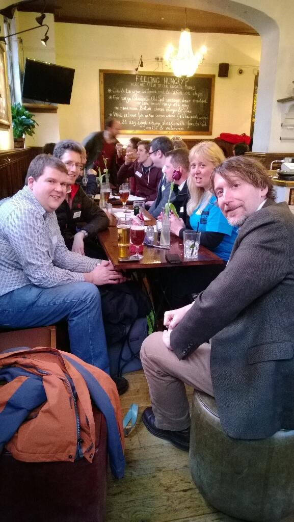
There were plenty of questions from the audience about the OGC too, and Bart talked about how standards can prevent vendor lock in, and bring consensus to the geospatial community. Everyone agreed it was an interesting event and we hope we can put on more of these events. We followed the event by the ever popular geodrinks at a local hostelry.